Traveling to Boston to visit Fenway Park
Boston has a reputation for confusing streets, stifling traffic, and a cramped airport, and that reputation is well-earned. That’s somewhat intimidating for incoming visitors. But on the plus side, Boston is a small city whose different neighborhoods are tightly packed, and once you get yourself settled at your destination, it’s easy to get around.
In this chapter, we’ll focus on getting you into the city, and when we later focus on where to stay, we’ll talk more specifically about getting you to your temporary front door. For now, let’s go to Boston by plane, train or (gulp) automobile.
How to Get to Boston
There are three basic choices when it comes to getting to Boston, and a couple of lesser options within those choices.
- Fly. Logan Airport is our hub here and your most obvious choice. The other airport options — T.F. Green in Providence, and Manchester-Boston Regional in New Hampshire — are not really worth the trouble. We’ll talk about both, but Logan is very strongly recommended.
- Train or bus. This could be an appealing option for those along the Acela corridor from Washington D.C. to Boston, but will likely be too much travel time for those outside that loop. Also, those on a budget and within a 300-mile-or-so radius of Boston might want to consider a bus (yes, really … a bus!).
- Car. Driving to Boston is difficult. Driving in Boston is even more difficult. Parking is no picnic, either, nor is it cheap. But, hey, if the road trip is your thing, it’s completely doable.
Flying to Boston
Logan Airport is typical of airports in the Northeast—cramped, fairly unfriendly in its layout, slow to get in, slow to get out, prone to detours, and lacking signage. It is in the midst of a lengthy facelift, (check for current BOS airport updates here) which can mean detours and slowdowns. But nearly four million passengers cycle through each month and for the great majority of them, it’s a smooth experience.
Once you do arrive in Boston and have your bags (and fellow travelers) collected, you must figure out how you’re getting into the city and on to your hotel … and of course, then on to Fenway.
There are five options here, and your hotel choice (we’ll discuss that next chapter) will influence which one makes the most sense for you:
1. Rideshare/taxi

Logan is one of the few airports where a taxi usually works out about the same as a rideshare. Taxi rides are metered, so traffic will cause some price fluctuation, and an extra $2.65 is added to your fare for tolls going into the city (there should be no such charge for going back to the airport, though). In all, a taxi ride from the airport into the city will run $25-40, plus tip. A rideshare will be about the same, but surge prices often will push the price higher. Check your rideshare app when you get to the airport. If it’s more than $40, then you’ll want to just head to the taxi stand.
2. Blue Line subway
Boston’s much-maligned subway system isn’t really so bad, and if you’ve got a little patience and not too much luggage, you can manage to get to your destination for $2.40. Outside of arrivals, there will be shuttles running every 5-10 minutes that take passengers from the terminal to the Blue Line—look for the blue-and-white bus with No. 22, 33, 55 or 66. Once at the Blue Line, purchase a ticket and get on the westbound (to Bowdoin, NOT Wonderland) side of the platform.
This is a really solid and cost-effective way to get to/from the airport. Sure, the shuttle bus to the station is a little inconvenient (we prefer the airports that have subway/train stations built right into them), but the process is easy and fairly quick, and we have no problem recommending the T as a viable way to get around. We think it’s nicer than both New York and Chicago’s systems, even though it has a tendency to be less reliable (with random delays and line closings, which is why we say it’s “much-maligned”).
If your hotel is in the Faneuil Hall/Financial District area, you’ll take the Blue Line just three stops to State, and you’ll likely be within walking distance of your door. If you are heading elsewhere, like Copley or Back Bay, you’ll need to transfer to the Green Line (which is Fenway’s line, too) at Government Center, which is just one stop further.
3. Silver Line bus
It’s a bus (marked SL1), though it is often listed as a train, but even if you’re bus-averse, it is a very good option for getting into town. It’s free, runs every 15-20 minutes, and has its own travel lane under the Harbor, which means you will dodge the worst of Boston traffic (not all, though—it does rejoin the city roads). It picks up passengers at the terminal and requires no transfers, with a 35-minute route that terminates at South Station.
From there, you can either get the Red Line on the subway, or go with a hybrid option and take a $10-15 taxi/rideshare to your hotel.
If you’re staying near South Station, we like this option. If not, we think the Logan Express or the Blue Line will be better options for you.
4. Logan Express
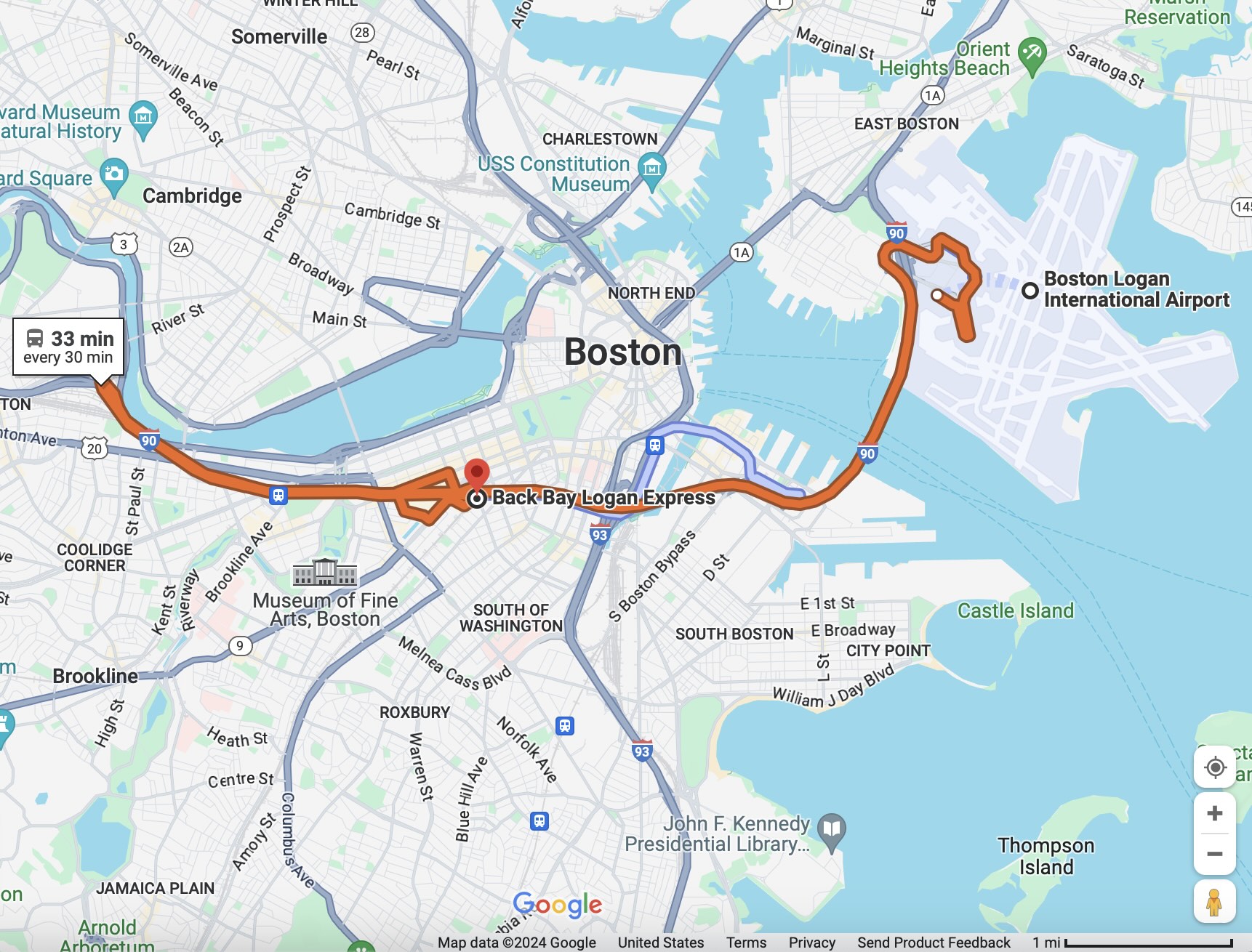
Does a free ride from Logan to the heart of Boston sound too good to be true? Sure it does. But meet Logan Express. Most locals think of it as a way for suburban travelers to get to the airport (and it does do that), but it services the convenient Back Bay, too. It can be picked up at any terminal (it runs every 30 minutes) and will drop you off right in front of the Prudential Center for a cost of … (drumroll) … nothing! And it’s just $3 to get back to Logan on the return trip.
Seriously … this is for real. The bus itself is a standard Boston city bus, which is completely fine: acceptably clean, appropriately safe, and because it’s an express bus from the airport to downtown, the only people on it are travelers heading to/from the airport. There are no stops along the way: it runs from Logan to Back Bay (two included stops), and then goes right back. And because there are no stops, the reality is that you’re getting to/from the airport in about the same time as a rideshare would. The only difference: it’s not dropping you off at your exact hotel, so you may have a walk from the stop to wherever you’re staying. But check your map and plot in “800 Boylston Street” or “145 Dartmouth Street” and you’ll see the hotels that are closest to a stop and easiest to walk to.
The only downsides are:
–The bus doesn’t tend to run quite on schedule. If you think it will be there exactly at the top and bottom halves of the hour, you’ll be disappointed. We can reasonably say that it will be there every 30 minutes. We just can’t tell you when those 30 minute points are. So just plan accordingly.
–There aren’t any luggage racks on these buses. So if you’re the last one on and it’s a packed bus, you’ll be playing a game of Tetris with your bags.
Nevertheless, we love the Back Bay Logan Express, and we also love the Copley area as a lodging spot for Fenway, so we suggest taking advantage of this.
Just make SURE you get on the orange Back Bay Logan Express bus at Logan (clearly marked — see the photos). Otherwise, you could find yourself on your way to Peabody or (gasp!) Framingham.
5. Car Rental

The first question you need to answer when you decide to rent a car in Boston is the following: am I sure about this? The second question is: did I read the first question?
OK, you’re sure you need a car. We’ll trust you on that. But please, give yourself ample time. You’ll take the blue-and-white shuttle, No. 22, 33 or 55, to the Rental Car Center, and it can be a long ride because it’s the final stop. Make sure you’ve got an idea what your route looks like before you start driving –- GPS is a huge help, but the turns and exits come quickly.
Flying near Boston
Back when Southwest was offering cut-rate fares but was not flying out of Logan, many travelers familiarized themselves with two further-out “Boston-area” airports: Manchester-Boston Regional Airport in New Hampshire and T.F. Green Airport in Providence.
But in 2009 Southwest started flying into Logan, and given the cost structures of airfares today, there’s no longer any cost benefit to avoiding Logan. So if it’s been a while and you’re thinking about alternate airports for a Fenway visit, stop thinking about it unless you have a specific reason to do so.
If you do have that reason, here are some quick travel notes to help you connect to Boston:
Manchester-Boston Regional Airport
54 miles north-northwest from Fenway Park, it’s a one-hour trip down 93 South with light traffic in a rental car (but don’t plan on light traffic). There is a Greyhound bus that runs from Manchester to Boston (South Station), but there is limited service. Check the Greyhound bus schedule here if you think this will be a good option for you.
Providence T.F. Green
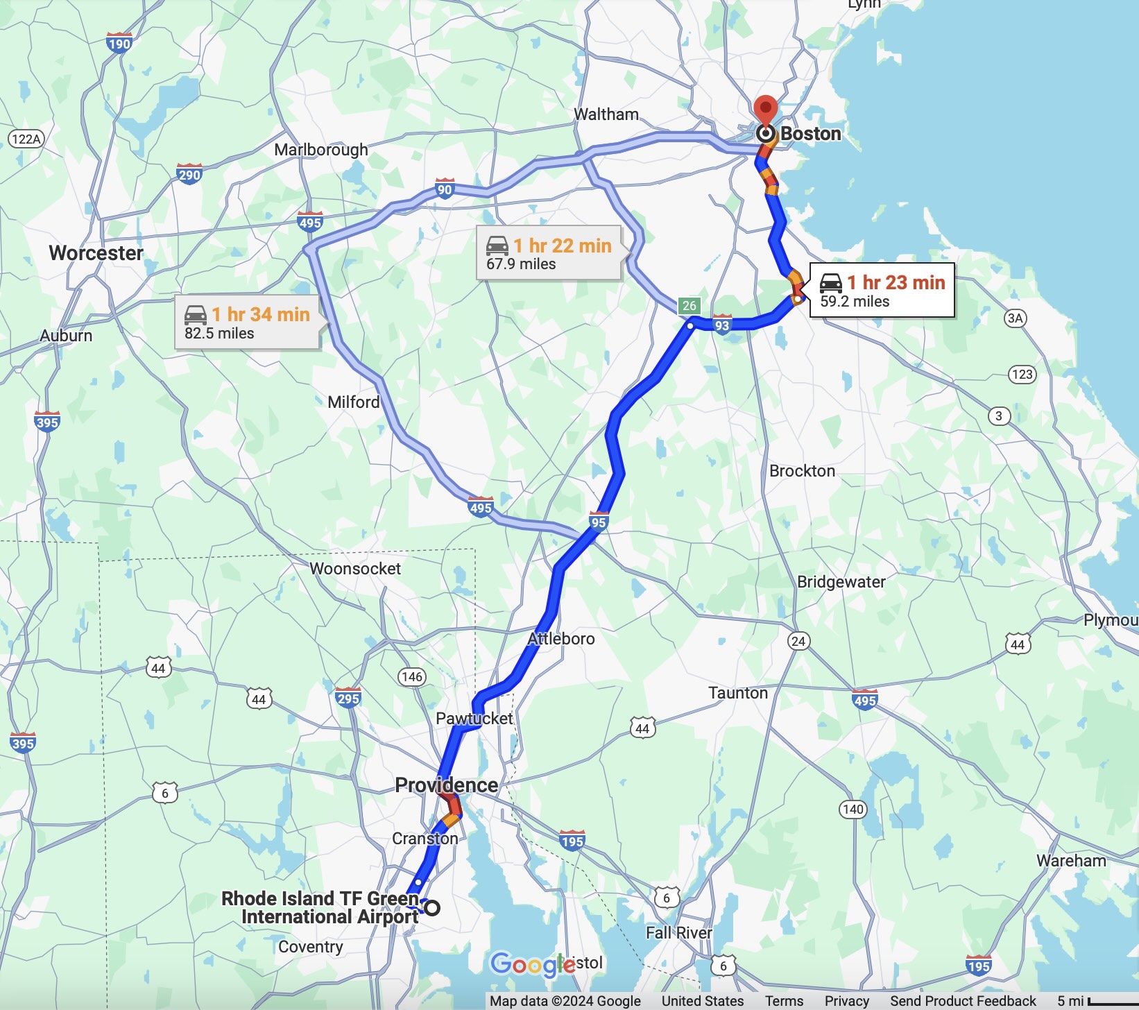
65 miles south-southwest from Fenway Park, it’s about a 75-90 minute ride by car. There is a commuter rail connection between Boston and Providence, but it takes nearly two hours in total—you’d need to first take a bus or rideshare from the airport (which is south of Providence) to the train stop (in downtown Providence). Like Manchester, this would only be worth it if the flights were significantly cheaper and usually, they aren’t.
Train to Boston

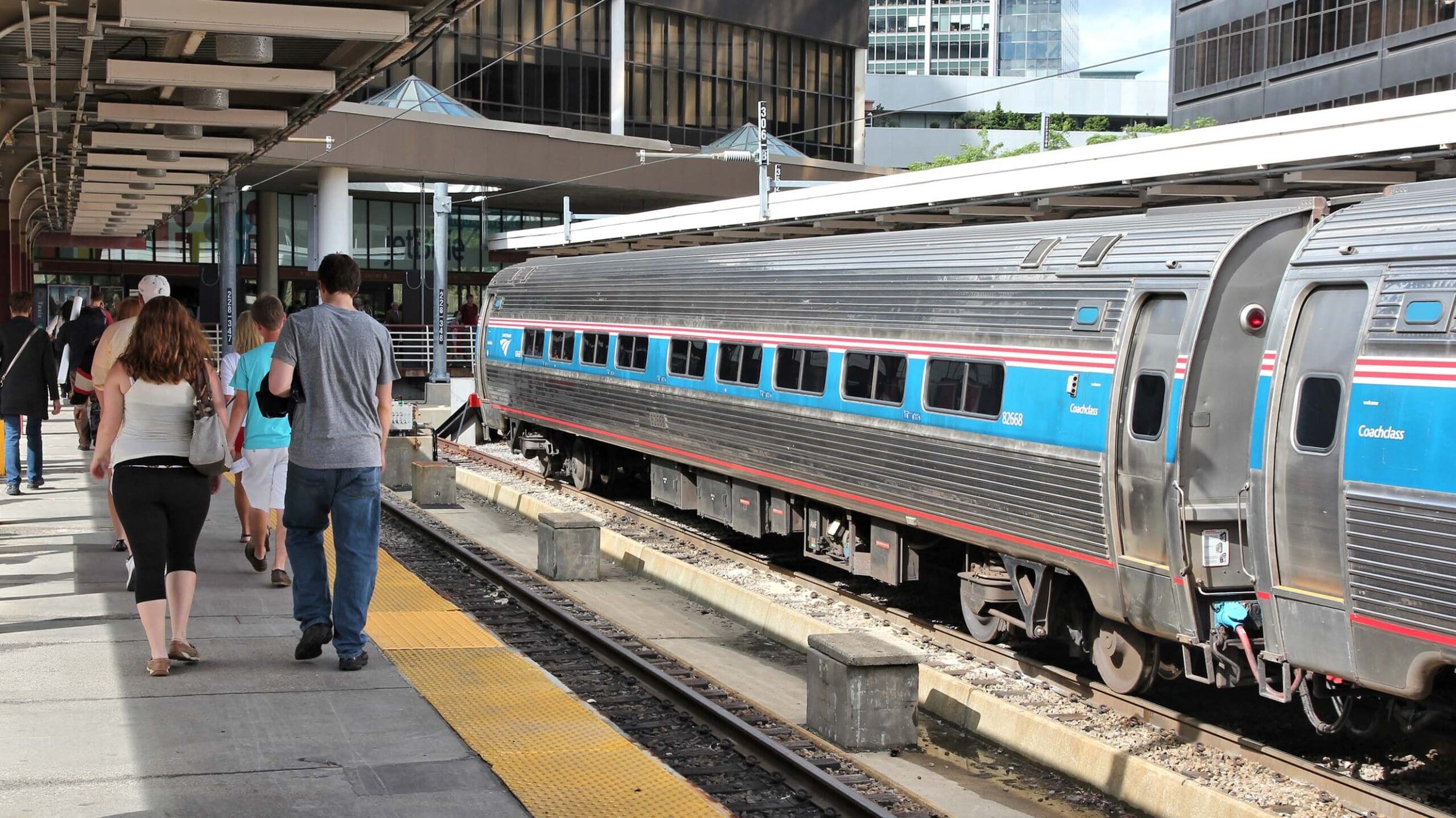
Convenience makes Amtrak a realistic option for those along the Northeastern seaboard. From New York City, the trip can take less than four hours, and when you add the time not spent getting from the airport into the city, the train ends up being a great option if it’s relevant for you.
There are two trains that run along this general route, the 150-mph express Acela, with just 16 stops, and the more extensive Northeast Regional, which is slower and makes roughly 31 stops between Washington and Boston.
There is a Back Bay stop in Boston, which comes about six minutes before South Station, and works just fine as a terminus for your trip. It is a smaller station that connects to the Orange Line and is convenient to downtown and Copley Square. The only drawbacks are that it is not a major station so there’s no cab stand outside, and for your outbound trip, there is no Amtrak ticket office on the premises should you need to talk with a representative.
Here’s how the timing to Boston from other Atlantic cities shapes up for different modes of transportation — but be aware, these are just approximate averages:
Approximate travel time to Boston (hours:mins)
| Departure City | Acela Time | NE Region Time | Bus Time | Drive Time |
|---|---|---|---|---|
| Washington D.C. | 6:45 | 8:15 | 10:20 | 7:50 |
| Baltimore | 6:15 | 7:30 | 9:30 | 6:50 |
| Philadelphia | 5:20 | 6:15 | 7:20 | 5:15 |
| Newark, NJ | 4:15 | 5:00 | 5:30 | 4:10 |
| New York | 3:45 | 4:20 | 4:30 | 3:45 |
| New Haven, CT | 2:05 | 2:30 | 2:45 | 2:20 |
As for price, you’ll find some pretty wild variations — you could pay as little as $120 round trip on the train between New York and Boston, or as much as $350. The Acela is always at least a little more expensive because it’s faster and there is no coach option, but you can save some money by mixing and matching fares — take the Acela to Boston and the Regional home, for example — on the arrival and departure.
Bus to Boston
The bus, of course, is always much cheaper, as little as $60 round trip from New York or $100 from Washington. Seating is tight, though, and you’ll have to deal with a cramped bathroom, no snack car and the usual traffic.
If you’re coming from Northern New England, chances are you’ve already got a handle on how to navigate Boston. For Vermont and most of New Hampshire, driving is the only real choice. The Amtrak Downeaster, though, runs along the Maine coast from Brunswick to Boston’s North Station (conveniently located on the Green Line) five times daily.
Drive to Boston

At this point, we feel we’ve offered sufficient warning: don’t drive into Boston. But you’re your own person. You want to get nuts? Let’s do it.
Really, it’s not that bad driving to Boston, the main issue is what to do with a car once you’re there, in a crowded city patrolled by an army of very aggressive meter monitors.
If you are driving, there are two basic routes.
Route 90 (the Mass Pike) from the west
This is a typical big-city highway, with hefty traffic but with a straightforward system of exits and onramps. Most navigation systems will, eventually, funnel you to 90. We’ll get into the details of getting from the Pike to the park, but it’s only a little less than three miles from the point at which you exit the Pike to Fenway Park. It’s doable.
Route 95/93 from the south
This is not a typical big-city highway and, fortunately, most out-of-towners heading to Fenway won’t be coming this way. But 95 splits into Route 93 just south of the city, and those 22 miles, from the moment you’re thrust onto 93 until you reach Fenway, are full-contact Massachusetts driver miles.
We’ll break down the specific route, and with a bit of luck, you’ll get there unscathed. But when you do, you’ll be older, wiser and utterly white-knuckled. Hopefully, you’ll have some good stories for your friends, to boot.
Bottom Line
If you’re traveling to Boston by air, fly to Logan unless you have a very specific reason not to. If you’re within range for taking Amtrak, do that – it’s much easier than flying. If you’re coming in by car, that’s fine — just leave yourself plenty of time to navigate Boston’s freeways and find parking.


